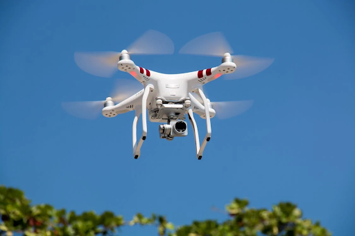
Urban landscapes, previously seen majorly from the ground level, are now being redefined through the lens of aerial photography, thanks to the invention of drones. These unmanned aerial vehicles (UAVs) equipped with high-resolution cameras have changed the way we capture and perceive cities. From skyscrapers to bustling streets, drones offer a unique vantage point that reveals the dynamic interplay of architecture, infrastructure, and human activity from above. In this article, we will discuss how drone photography is reshaping our understanding and comprehension of urban environments across the world.
Aerial Exploration: Seeing Cities from a New Angle
Drone photography allows us to explore cities in ways that were once unimaginable. By lifting us above the rooftops and providing sweeping views, drones allow photographers and enthusiasts alike to appreciate the intricate patterns and structures that define urban landscapes. From iconic landmarks to hidden gems, every area of a city becomes a canvas for artistic expression and documentation.


Imagine hovering above New York City’s Central Park at sunrise, capturing the tranquil oasis amidst a sea of skyscrapers, or gliding over London’s River Thames to showcase the blend of historic architecture and modern developments. These aerial perspectives not only highlight the beauty of modern design but also emphasize the scale and complexity of man-made settlements.
Capturing Modern Diversity and Evolution
One of the most compelling aspects of drone photography is its ability to capture the diversity and evolution of urban spaces over the peiod of time. Cities are continously changing, with modern buildings rising, neighborhoods evolving, and infrastructure increasing. Drones provide a vital tool for documenting these transformations, providing a historical record of urban development and societal improvements.
For instance, in cities such as Dubai or Shanghai, drone photographers have documented the rapid rise of futuristic skyscrapers and innovative urban planning projects. These images not only showcase architectural marvels but also reflect the economic growth and cultural shifts shaping these global metropolises.
Revealing Patterns and Symmetry
From above, cities often reveal hidden patterns and symmetrical designs that are invisible from street level. Grid-like street layouts, geometric rooftops, and repetitive architectural elements create mesmerizing compositions when captured from a drone’s angle. This bird’s-eye view challenges our conventional understanding of urban spaces, encouraging us to appreciate the beauty of symmetry and order amidst the chaos of city lifestyle.
In cities like Barcelona or Brasília, famous for their distinctive urban planning and architectural styles, drone photography captures the precision and creativity behind their layouts. The symmetrical patterns of roads, parks, and buildings come alive, offering viewers a new appreciation for the meticulous planning that shapes modern cities environments.
Enhancing Urban Planning and Development
Beyond aesthetics, drone photography plays a vital role in urban planning as well as its development. City officials, architects, and urban planners use aerial imagery to assess infrastructure requirements, monitor construction projects, and plan future developments. Drones offers real-time data and reports that gives decision-making processes, ensuring sustainable growth and the best use of urban land.
In cities such as San Francisco or Tokyo, where space is at a premium, drones assist identify opportunities for urban renewal and revitalization. By mapping out areas for green spaces, transportation routes, and housing developments, drone technology contributes to make it livable, resilient cities that meet the requirements of their residents.
Inspiring Creativity and Innovation
Drone photography has democratized the art of capturing urban landscapes, empowering photographers of all skill levels to uncover the creativity of the designers. Amateur enthusiasts and professional photographers unlike others take drones to experiment with composition, lighting, and storytelling techniques that were once reserved for ancient aerial photography.
Platforms like Instagram and Flickr have become showcases for drone photography enthusiasts to contribute their unique perspectives on cities around the globe. From abstract aerial views of cityscapes to intimate portraits of urban life, these images spark conversations and inspire others to see their surroundings with fresh views.
Overcoming Challenges and Ethical Considerations
While drone photography offers various benefits, it also raises ethical and regulatory challenges. Privacy concerns, airspace regulations, and safety precautions are the important factors for drone operators, especially in densely populated urban areas. Responsible drone use include respecting privacy rights, obtaining required permits, and adhering to flight restrictions to ensure the safety of both humans and property.
Adding more to this, the proliferation of drones has led to debates about their effect on wildlife, noise pollution, and the environment. Balancing the advantages of aerial photography with environmental stewardship remains an ongoing challenge for drone operators and policymakers alike.
The Future of Urban Drone Photography
Looking ahead, the future of urban drone photography has exciting possibilities. Advancements in drone technology, involves improved camera capabilities and autonomous flight modes, will continously expanding the creative potential of aerial photography. From 3D mapping and virtual tours to immersive experiences, drones are poised to changing how we perceive, use, and design urban landscapes.
As the advancements of cities and embrace smart technologies, drones will play an increasingly integral role in urban planning, environmental monitoring, and disaster response. Whether capturing the vibrant energy of Times Square or the historic charm of Parisian boulevards, drones provide a powerful tool for storytelling and visual communication in the digital period.
Conclusion
Finally, drone photography is changing our understanding of urban landscapes by providing a unique perspective that transcends traditional boundaries. From capturing architectural marvels to unholds hidden patterns and fostering creative expression, drones allows us to see cities in new and inspiring ways. As technology continues to evolve and regulations adapt, the potential for drones to improve urban planning, cultural preservation, and community engagement is limitless. By embracing the art and science of drone photography responsibly, we can harness its transformative power to create more inclusive, sustainable, and visually captivating cities for generations to come in future.
Through the lens of a drone, the sky is no longer the limit—it’s a gateway to new perspectives on the modern world we call home.
Keep an eye for more latest news & updates on USA Techmagazine!